
DAYTON — A Severe Thunderstorm Watch has been issued for Auglaize and Mercer counties in Ohio, and Randolph County, Ind., until 6 p.m.

Strong to severe storms are possible Monday and Tuesday evening ahead of a cold front. The ingredients are there to help fuel the storms. A strong southwest wind helps to pull in moisture from the Gulf and temperatures rise into the middle to upper 80s. A boundary adds lift and the jetstream tilts just right.
[DOWNLOAD: Free Storm Center 7 Weather app for alerts as news breaks]
Monday’s storms will arrive late afternoon and evening. Storms will push in from the NW and become more widespread after 5 PM. Wind is the primary threat with gusts possible over 60 MPH. Small hail is also possible with a few stronger storms Monday evening.
[WATCH Storm Center 7 Weather on the following devices]
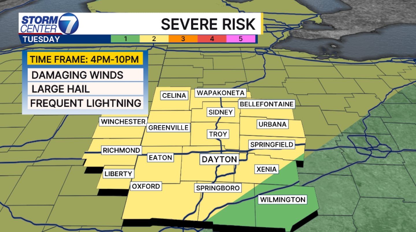
Tuesday’s storm threats are more likely with the approaching front. All hazards are possible, wind and hail are the primary concerns. However, isolated tornadoes are possible.
Storms will push through the Valley after 7 PM and linger throughout the overnight hours. The severe weather threat should be over before midnight Wednesday.
©2026 Cox Media Group


