
DAYTON — UPDATE @ 4:00 A.M.
All flood advisories for the region have been canceled.
UPDATE @ 2:45 A.M.
A Flood Advisory has been canceled for Auglaize, Shelby, and Logan counties.
UPDATE @ 1:30 A.M.
A Flood Advisory has been canceled for Union, Wayne, Butler, Darke, and Preble counties.
UPDATE @ 12:45 A.M.
A Flood Advisory has been issued for Auglaize, Logan, and Shelby counties until 2:45 a.m.
A Flood Advisory has been issued for Greene, Miami, Montgomery, and Warren counties until 3:45 a.m.
-INITIAL STORY-
It has been a soggy Saturday at times across the Miami Valley with some dry time squeezed in.
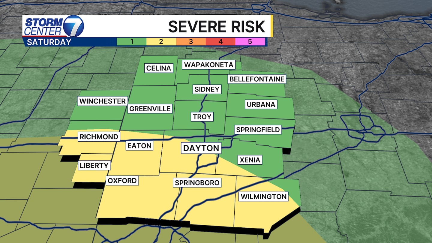
Meteorologist Nick Dunn here to update you on what we are watching for this evening, as we have a small window for severe weather and heavy rainfall.
The Storm Prediction Center maintains a Level 1 to Level 2 risk of severe weather.
Most storms will not turn severe, but one or two may briefly produce damaging wind gusts or a brief tornado.
These setups do not necessarily need every ingredient to be off the charts.
However, we have just enough that the potential exists.
[DOWNLOAD: Free Storm Center 7 Weather app for alerts as news breaks]
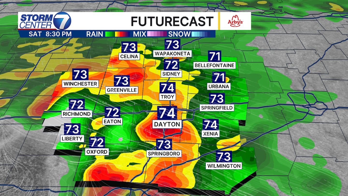
Looking at the timing for severe storms, anywhere from 4 PM to 10 PM gives us the best chance of any storms producing severe weather.
If you have outdoor plans or need to head out, just be ready to pivot if storms head your way.
Locally heavy rainfall will accompany the storms as well.
[WATCH Storm Center 7 Weather on the following devices]
Some localized flooding is possible if locations receive multiple downpours over a short period of time.
Most have already observed 0.25-0.50 inches of rain to this point.
Additional rainfall tonight may vary greatly in spots, but should range between 0.25 and 1.50 inches for most, with isolated higher amounts possible.
Have ways to get warnings this evening.
©2026 Cox Media Group


