DAYTON — Good evening to you on this Sunday. Meteorologist Nick Dunn here to share some new information about rain chances this week.
We had lots of sunshine this afternoon after some early morning storms, and highs made it into the middle 80s.
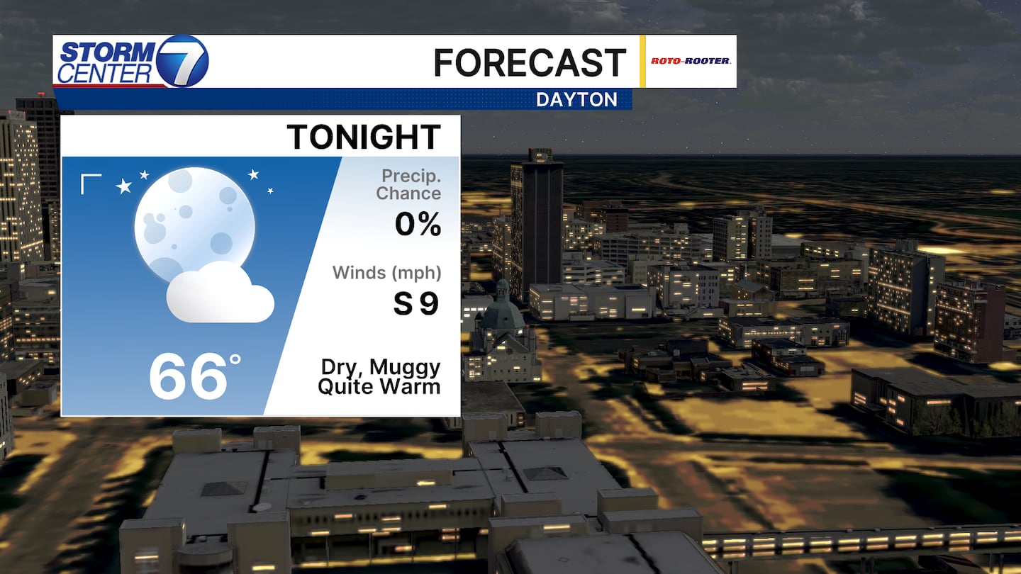
Calm weather sticks around for tonight with lows in the middle 60s.
By late Monday, things look to change.
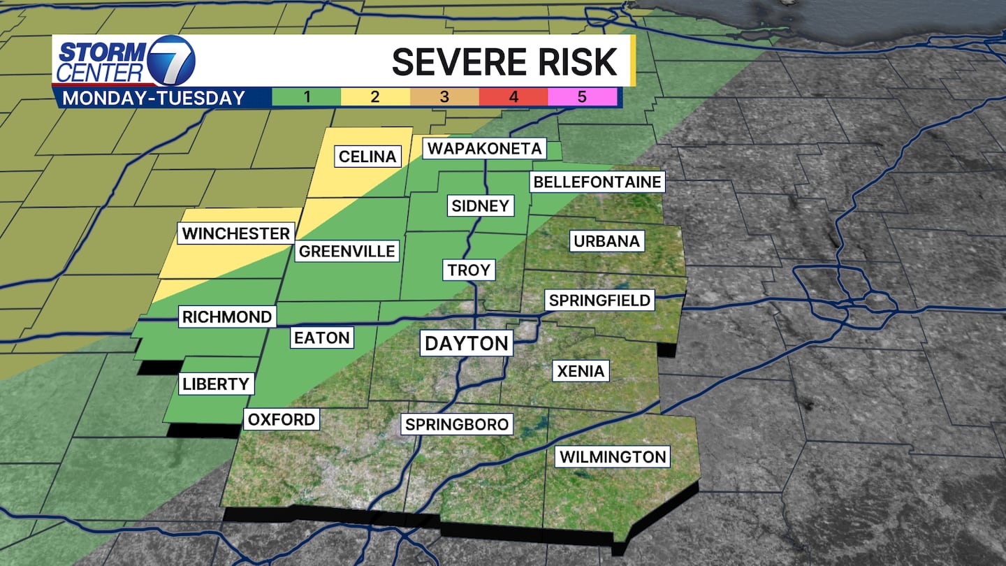
The Storm Prediction Center (SPC) has a small severe risk just to the northwest of Dayton.
Storms should weaken upon approach, but a few damaging wind gusts are possible.
[DOWNLOAD: Free Storm Center 7 Weather app for alerts as news breaks]
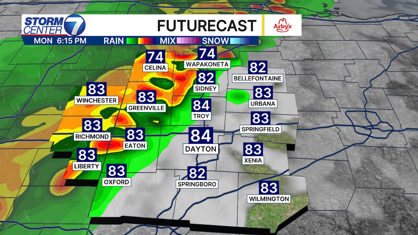
Timing and placement are a bit inconsistent from one model run to the next, but indications point towards storms trying to enter around 5-7 pm, but again, these should be weakening as they outrun the better ingredients.

By Tuesday afternoon and evening, the cold front approaching should help to trigger more storms.
The better chances for severe storms will set up northwest of Dayton again, where ingredients are likely to be more favorable, and the timing overlaps that should support more organized storms.
[WATCH Storm Center 7 Weather on the following devices]
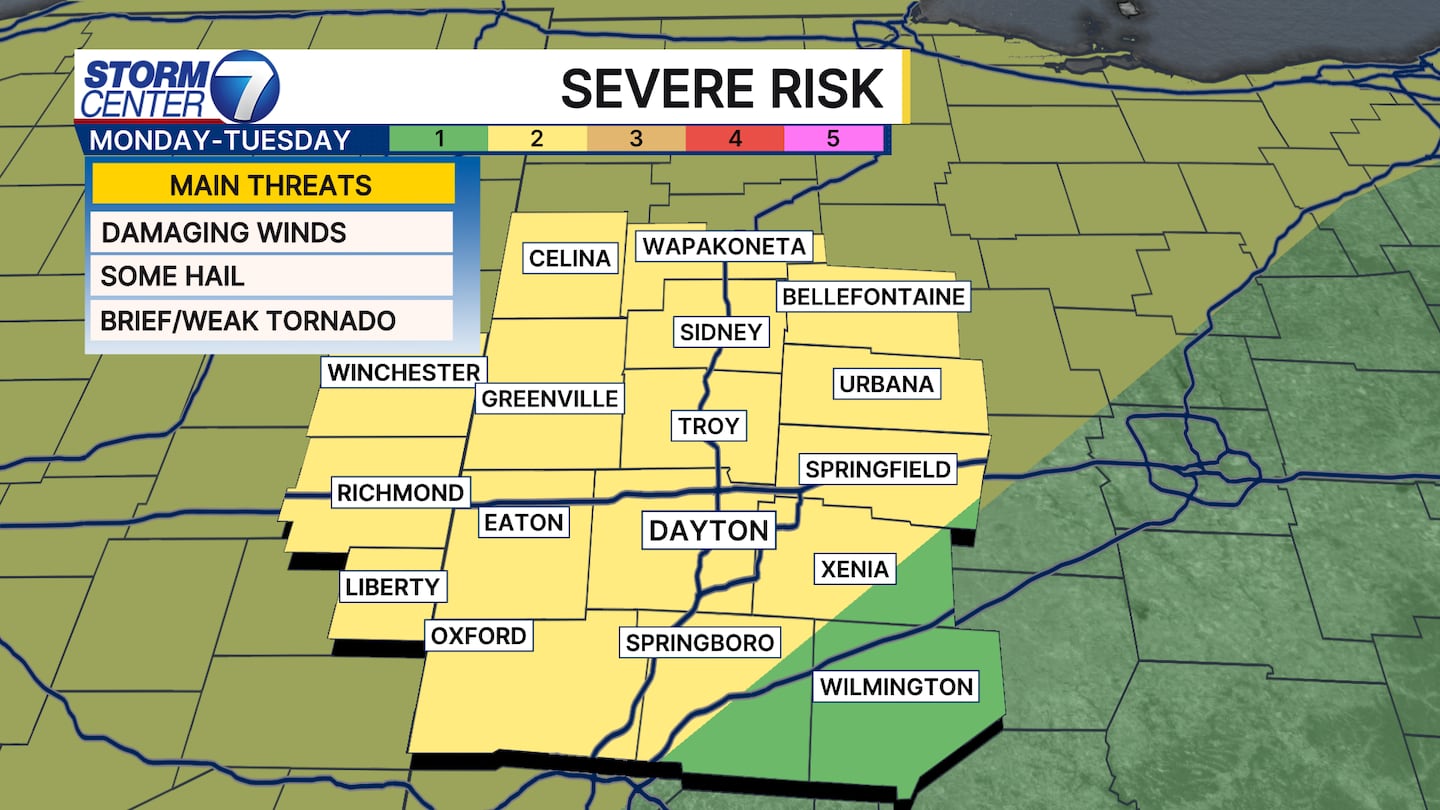
Nevertheless, a Level 2 Risk for severe storms is in place for most of us. Damaging winds are the main threat, but some hail or a brief tornado cannot be ruled out.
However, wind remains the number one risk.
Heavy downpours and lightning, of course, are hazards as well.
©2026 Cox Media Group