QUICK-LOOK FORECAST:
- Storms, some severe expected tonight
- THREATS: Large hail, damaging winds, isolated tornado
- Cooler but dry end to work week
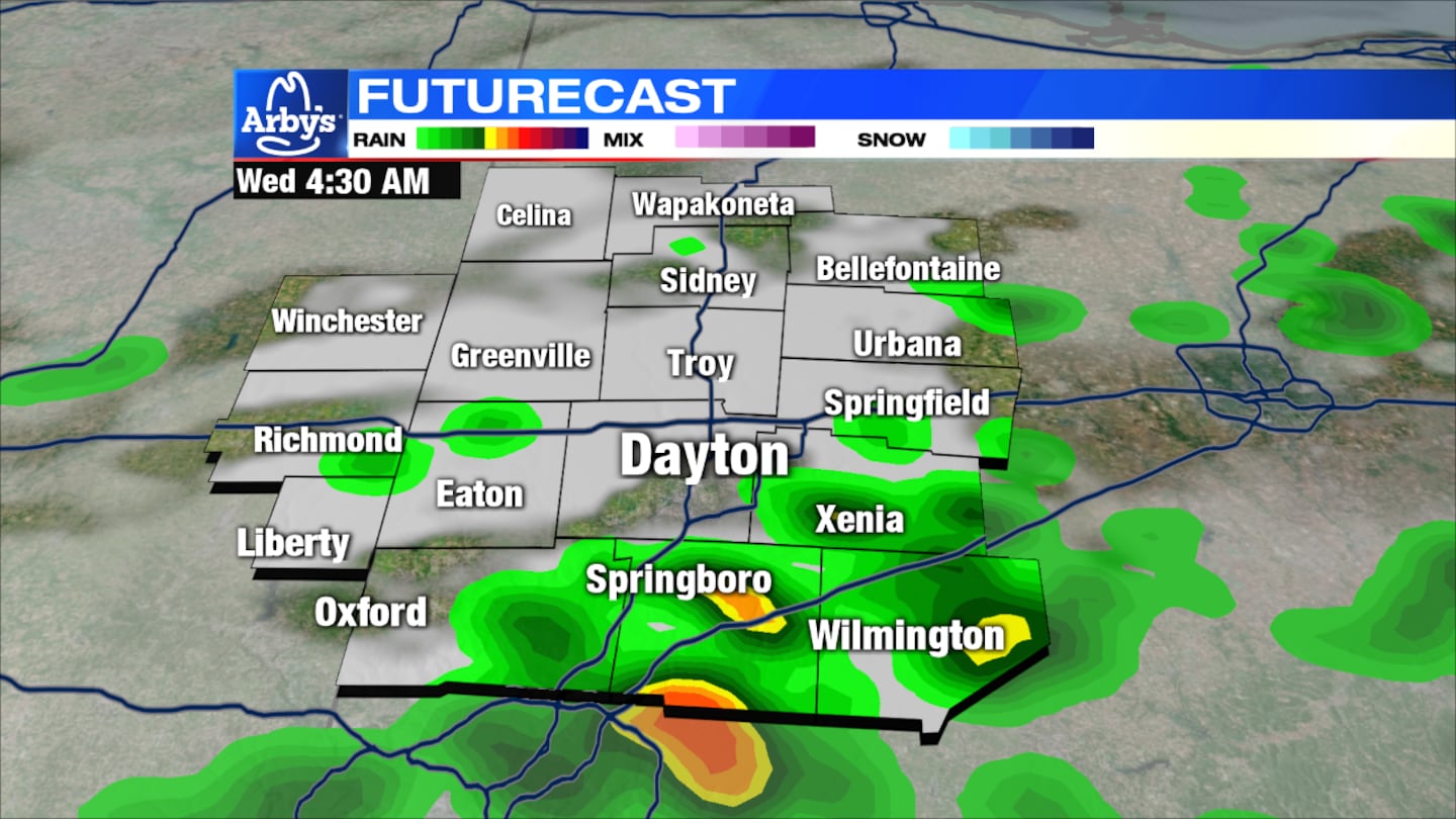
UPDATE @ 2:50 a.m.: A Severe Thunderstorm Warning is in effect for Southern Champaign, Southeastern Darke, Greene County, Montgomery, Maimi, and Clark County until 3:30 a.m.
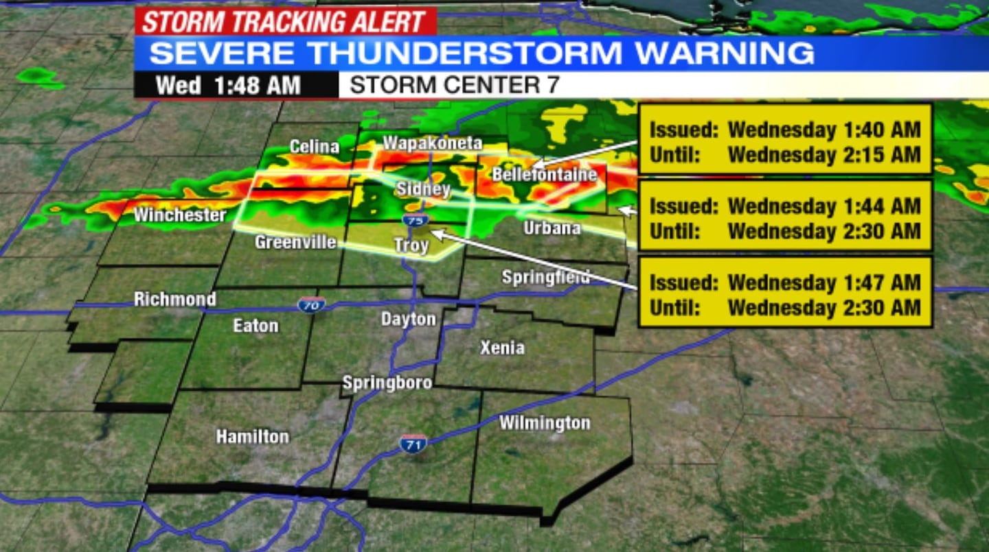
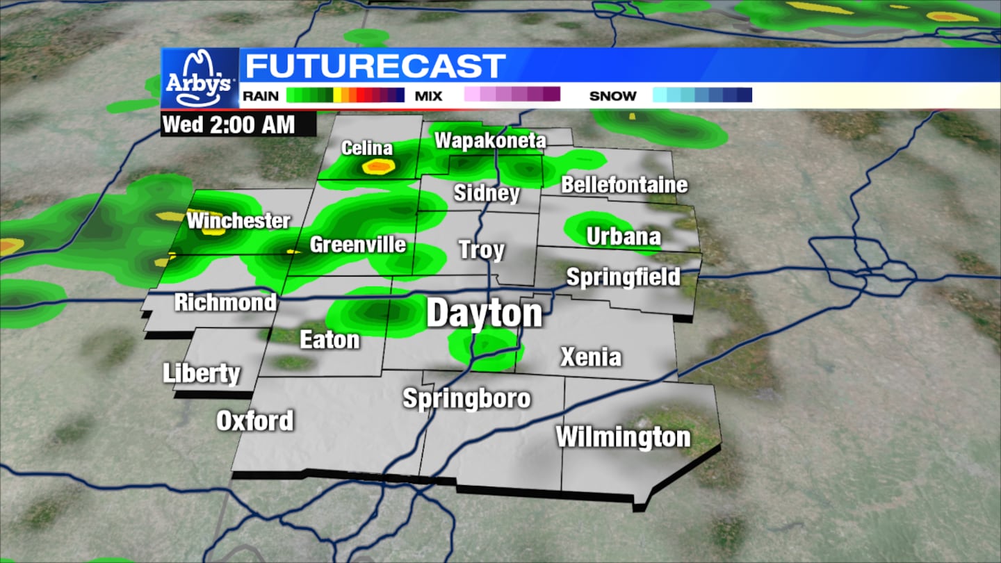
UPDATE @ 1:53 a.m.: New severe thunderstorm warning issued for Auglaize, Darke, Mercer, Miami, and Shelby County until 2:30 a.m. Damaging winds and penny size hail possible. Wind gusts are reaching 53 mph near Bellefontaine Airport.
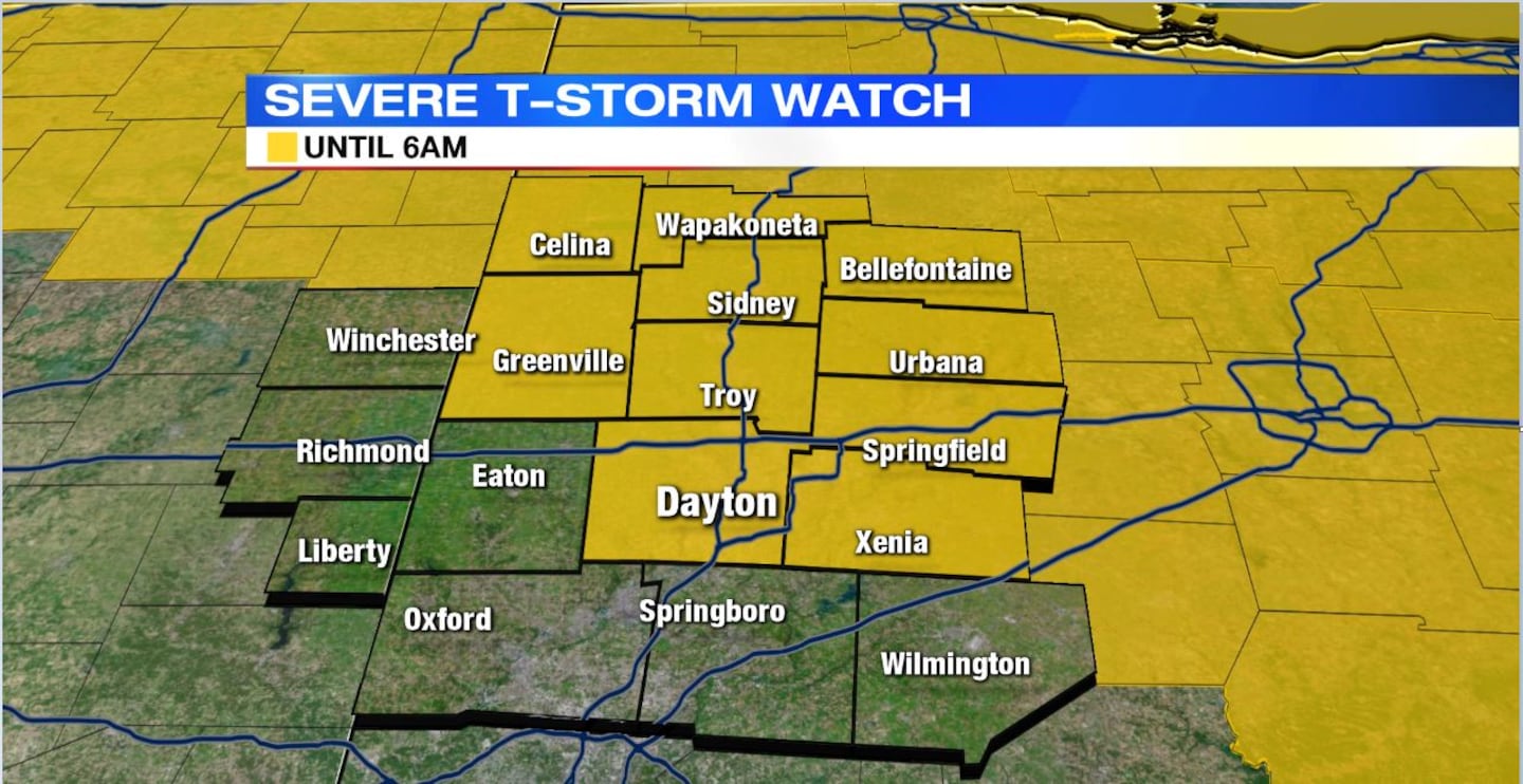
UPDATE @ 11:44 p.m.: The severe thunderstorm watch has been expanded to include Champaign, Clark, Greene, Logan, Miami, Montgomery and Shelby counties until 6 a.m. The same watch, for Mercer and Auglaize counties, continues until 3 a.m.
>> Track the conditions with Live Doppler 7 Radar
DETAILED FORECAST:
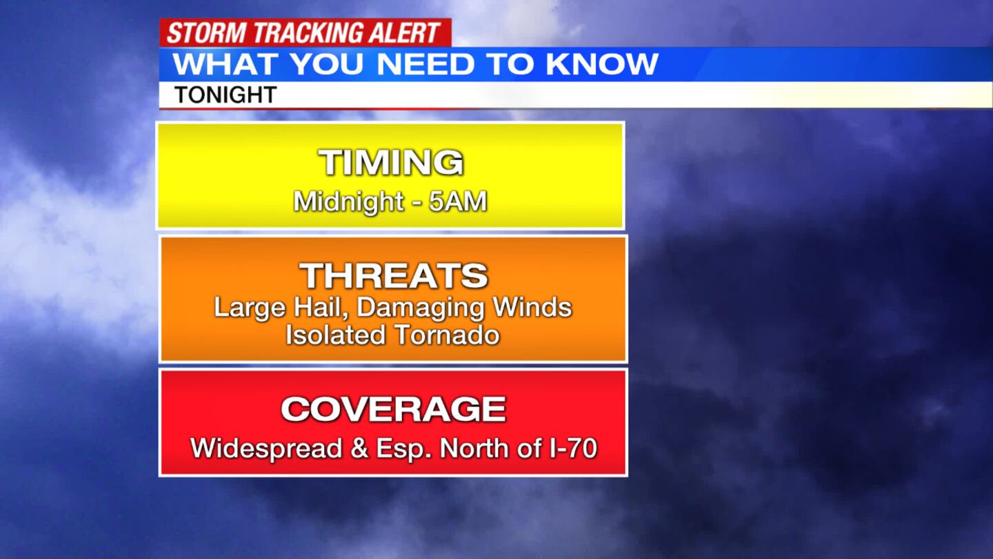
OVERNIGHT: News Center 7 Chief Meteorologist McCall Vrydaghs said storms, some severe, will move into the Miami Valley from the north and spread south after midnight. Large hail and damaging winds are the primary threat throughout the entire area, but will be a greater risk north of I-70. An isolated tornado or two is also possible. These storms are expected to end to the south and around 5 a.m.
Now is the time to prepare, Vrydaghs said. Move cars into the garage to keep them from hail damage. Turn on your weather radio and allow push notifications to the WHIO Weather app before heading to bed. These will send audible alerts if a watch or warning is issued.
>>Stay up-to-date with the WHIO Weather App for your device
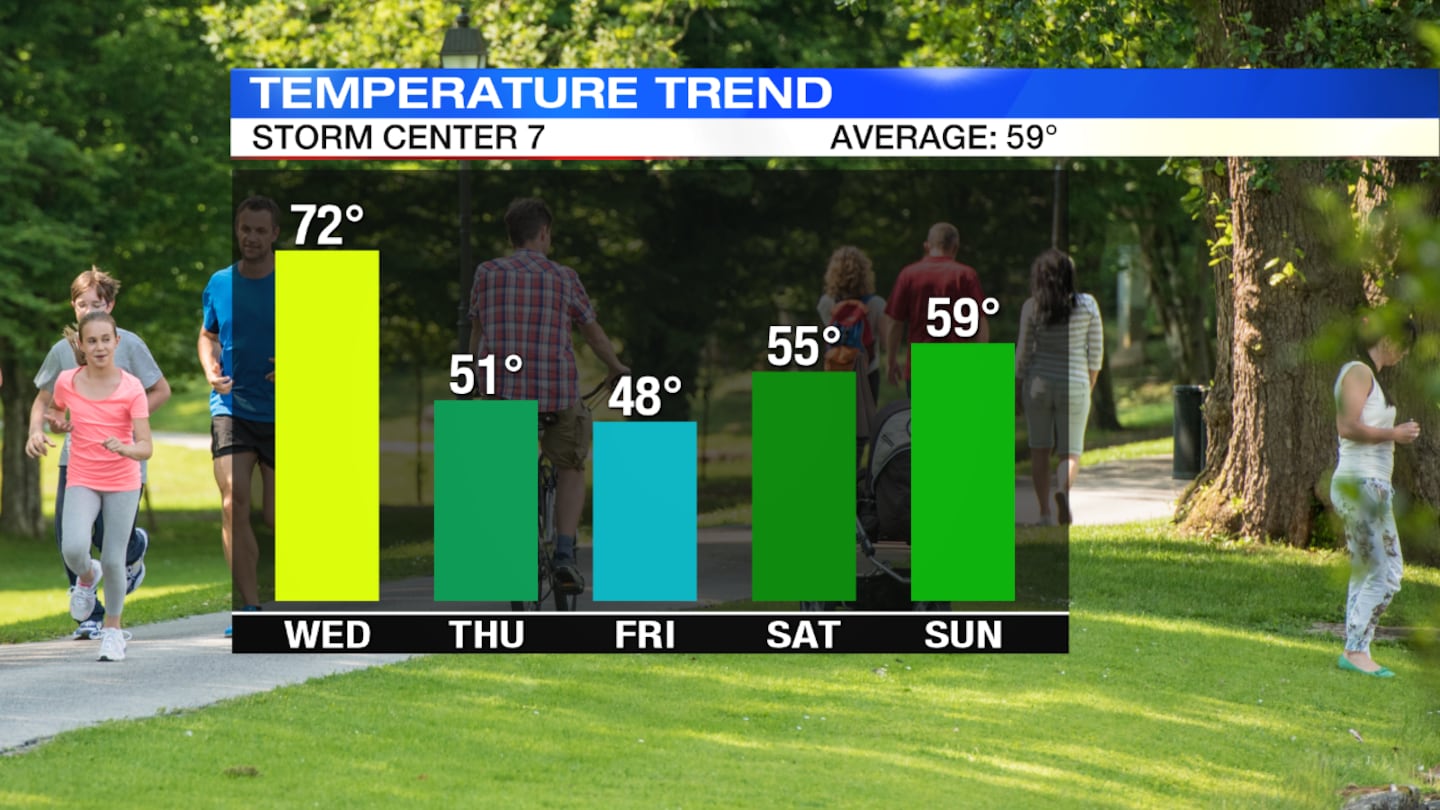
WEDNESDAY: Conditions will be dry by sunrise with clouds breaking for sunshine into the afternoon. It will be another warm day and windy with highs in the lower 70s. A cold front will bring rain and storms back into the Miami Valley Wednesday night. Severe threat is very low, but the best chance will be south of I-70. Damaging winds and small hail will be the primary concern along with isolated minor flooding.
THURSDAY: Any lingering showers will end early Thursday morning. It will be dry for the afternoon with some broken clouds. Expect a cooler day with highs in the lower 50s. It will also be windy.
FRIDAY: We will see a chilly morning in the 30s. Some areas of frost are possible. There will be sunshine and a few clouds during the day. It will be cool with highs in the upper 50s.
SATURDAY: It will be a dry start to the weekend with highs in the middle 50s.
SUNDAY: Scattered showers are likely and it will be breezy for Sunday with highs in the upper 50s.
© 2020 Cox Media Group


