
MIAMI VALLEY — A few snow flurries are expected to fly overnight through the daytime hours on Thursday. The main event will be with a region of steady snow developing on Thursday night.
Accumulations look likely with travel impacts possible.
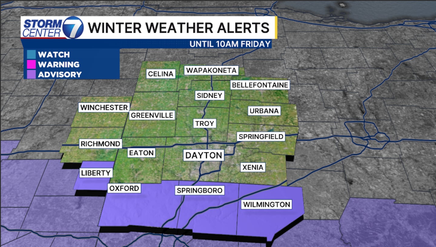
A Winter Weather Advisory has been issued for Butler, Warren, and Clinton counties from 7 p.m. tonight until 10 a.m. on Friday. It also includes Union County in Indiana.
[DOWNLOAD: Free Storm Center 7 Weather app for alerts as news breaks]
Storm Center 7 Meteorologist Britley Ritz continues to TRACK this system. She has the latest TIMING and IMPACTS today on News Center 7 at Noon.
[WATCH Storm Center 7 Weather on the following devices]
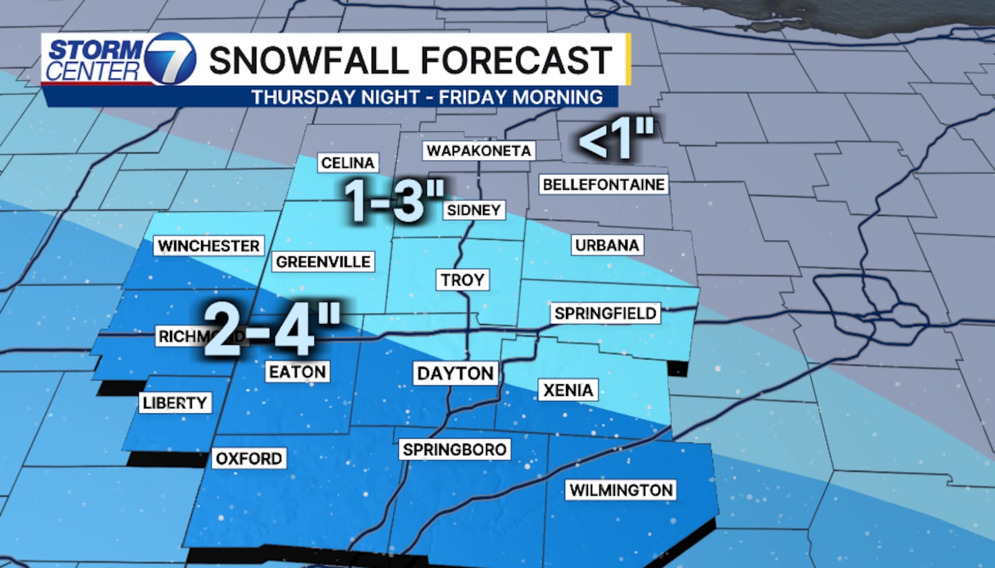
Snow is expected to begin spreading across the area by 8 p.m. on Thursday.
Snow will taper off on Friday morning.
Accumulations of 2-5 inches appear possible for the Dayton area. Lighter totals look more likely further northeast.
We’re dealing with a narrow corridor of heavier snow, so small storm track changes can easily shift our totals up or down.
Either way, prepare for snow-covered roads Thursday night into Friday morning.
A second, possibly stronger system, moves through on Saturday.
With temperatures in the 20s, this will also be an all-snow system for us with accumulations, and travel impacts are likely.
We’ll get a more detailed look at how Saturday will evolve today.


