
MIAMI VALLEY — Multiple rounds of thunderstorms are expected to move into the Miami Valley this weekend.
A Wind Advisory goes into effect Saturday from 2 a.m. until 8 p.m. for most of the region.
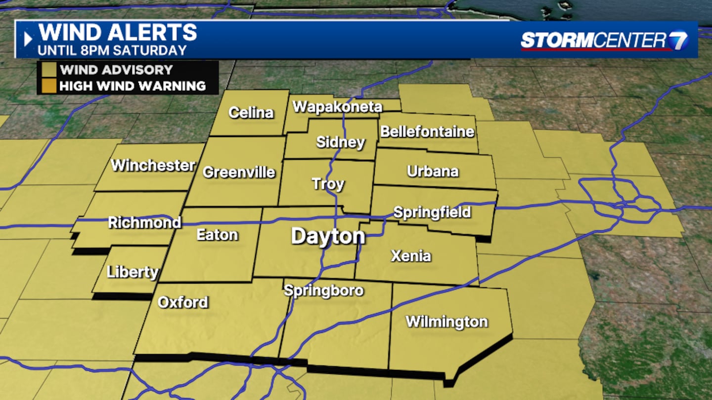
This includes Auglaize, Butler, Champaign, Clark, Clinton, Darke, Greene, Logan, Mercer, Miami, Montgomery, Preble, Shelby, and Warren counties in Ohio.
It also includes Union and Wayne counties in Indiana.
There is also a Wind Advisory for Randolph County until 4 p.m. Saturday.
[DOWNLOAD: Free WHIO-TV News app for alerts as news breaks]
Our Storm Center 7 meteorologists continue to TRACK this system. They have the latest TIMING and IMPACTS today on News Center 7 at Noon and 5 p.m.
TRENDING STORIES:
- Flames, smoke visible as firefighters battle house fire in Dayton
- Suspect dead after shooting, car chase that led deputies to find woman’s body
- Suspect dead after shooting, car chase that led deputies to find woman’s body
The first line of storms is expected between 3 a.m. and 8 a.m.
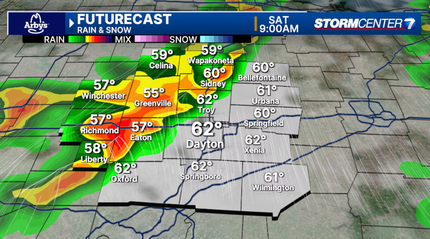
Heavy rain, occasional cloud-to-ground lightning, and gusty winds look to be the main issues. An isolated storm may have damaging winds. A few may become severe.
During the daytime hours, Storm Center 7 Meteorologist Britley Ritz says it will be partly cloudy, warm, and very windy. She said isolated thunderstorms may develop.
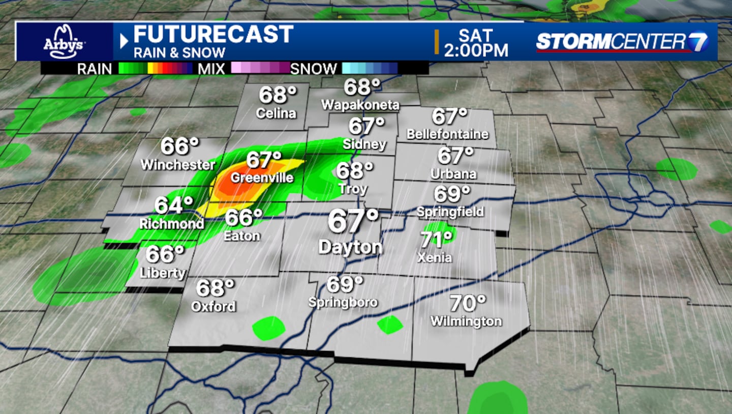
“Any storm that develops during the day may be strong to severe,” she said. “Damaging winds, isolated hail, or isolated tornado threats are possible during this window. During this timeframe, single-cell storms are most likely. While they will attempt a linear shape, single-celled storms have a greater risk of becoming severe and running the risk of rotating.”
Saturday night into Sunday morning, the timeframe for these storms is roughly 7 p.m.-3 a.m.
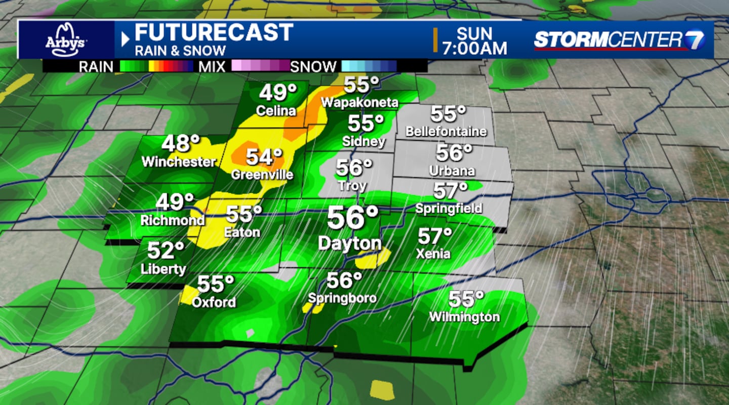
“Another widespread round of rain and storms is expected,” Ritz said. “Heavy rain and damaging wind gusts will be the main concerns here. Hail is unlikely during this timeframe. An isolated tornado cannot be ruled out.”
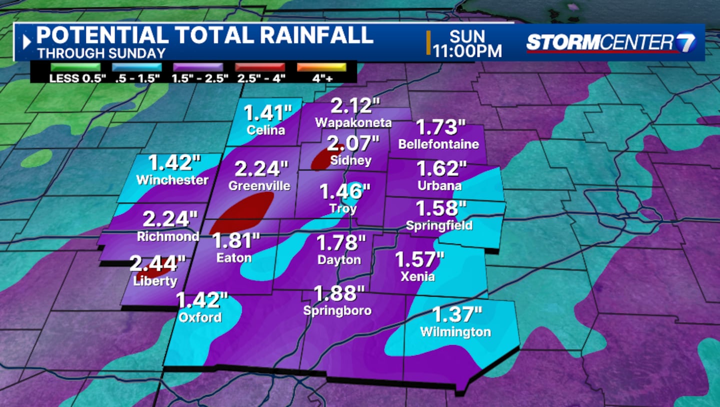
This round looks more of a heavy rain threat. It could potentially bring a heightened flood risk with over three inches of rain possible throughout the entire weekend.
Multiple rounds of heavy rainfall may lead to flash flooding. This is most likely late Saturday into early Sunday.
It will be windy from Friday evening through Sunday morning. Wind gusts not associated with thunderstorms may exceed 45 MPH at times.
Prolonged strong wind gusts may eventually lead to downed trees (uprooting of trees due to saturated grounds) and spotty power outages.
We will update this story.
[SIGN UP: WHIO-TV Daily Headlines Newsletter]
©2025 Cox Media Group


