MIAMI VALLEY — The Miami Valley will see periodic rain chances over the next few days.
The first chance will be this morning but the best chance for strong to severe weather could be this weekend.
[DOWNLOAD: Free WHIO-TV News app for alerts as news breaks]
Storm Center 7 continues to TRACK these rain chances. They have the latest TIMING and IMPACTS today on News Center 7 at Noon and 5 p.m.
TRENDING STORIES:
- State troopers, medics respond to reported crash in Montgomery County
- Former coach, teacher alleges wrongful termination by local school district
- Gun found in backpack at local elementary school
Heavy rain is expected to move in mid to late morning and linger throughout the early afternoon.
“A few rumbles of thunder are possible,” said Ritz. “Nothing severe expected. Low temperatures are VERY warm. Dropping only into the upper 40s.”
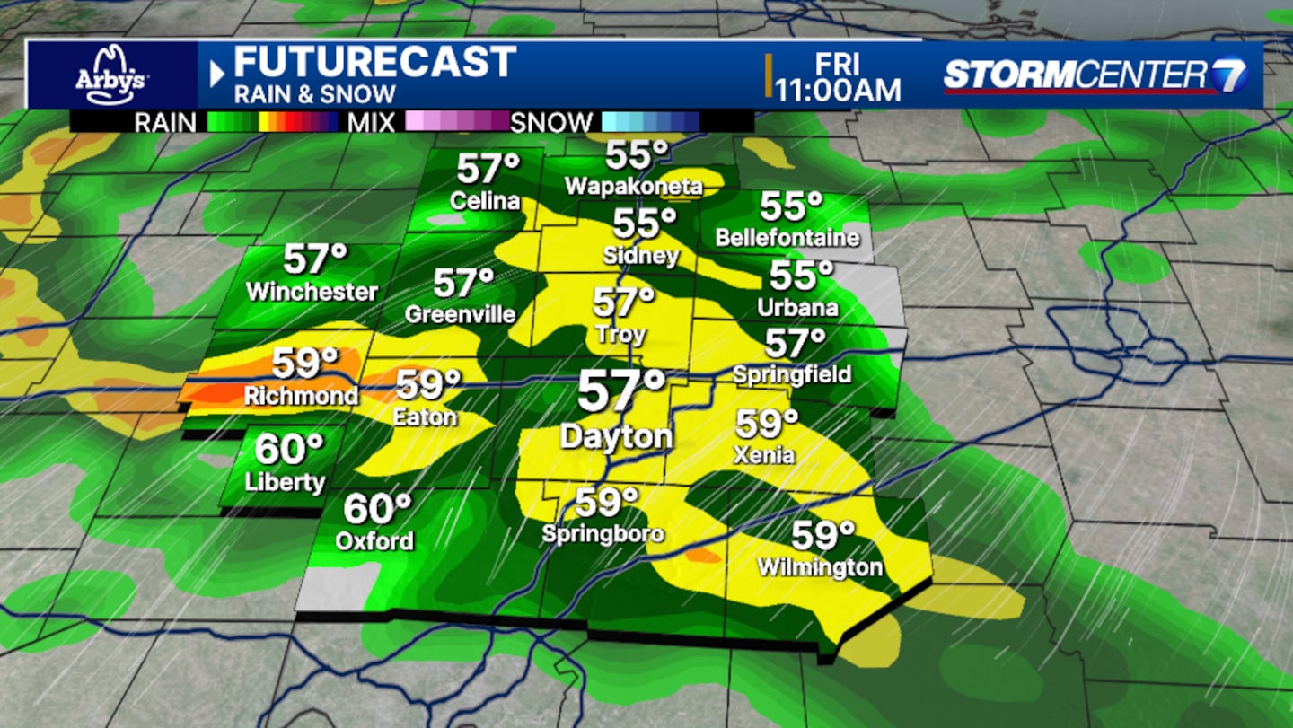
It will also be very windy with gusts over 40 MPH late today.
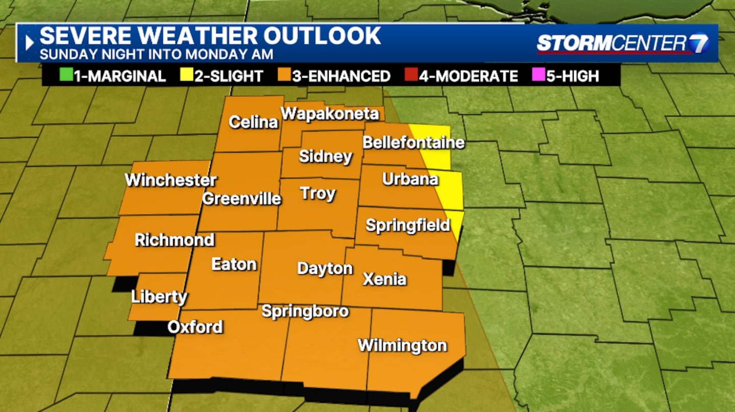
Ritz is tracking the chance for strong to severe storms on Sunday.
The Storm Prediction Center has put much of the Miami Valley under a Level 3 of 5 enhanced risk for severe weather Sunday.
TIMING
Ritz says forecast models are going and forth on how early the storms will begin.
She says the best timetable is between 9 pm Sunday through 3 a.m. Monday is the best chance for severe threats.
IMPACTS
The main threat is damaging wind with large hail also possible. An isolated strong tornado can’t be ruled out.
FORECAST CHALLENGES
Ritz says there is a highly uncertain threat due to the potential for persistent clouds after morning showers.
“If our atmosphere destabilizes earlier in the day-- the longer we gain some sunlight, we can heighten our risk for severe storms in the evening,” she added.
We will update this story.
[SIGN UP: WHIO-TV Daily Headlines Newsletter]
©2025 Cox Media Group


